
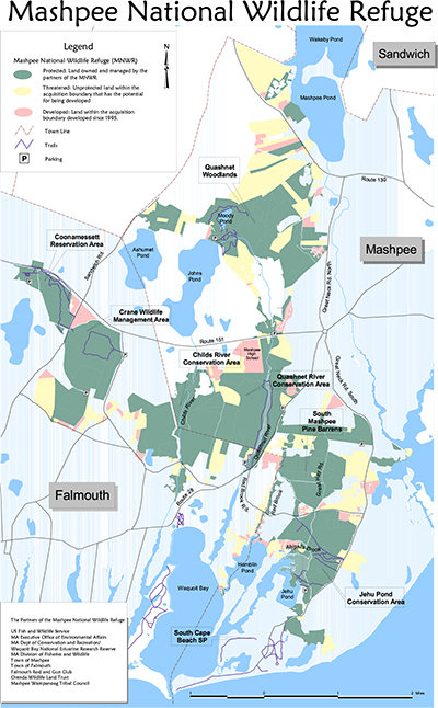
OVERVIEW MAP OF THE MASHPEE REFUGE
View Mashpee Refuge Overview Map
Download Entire Trail Map GuideIndividual Trail Maps:
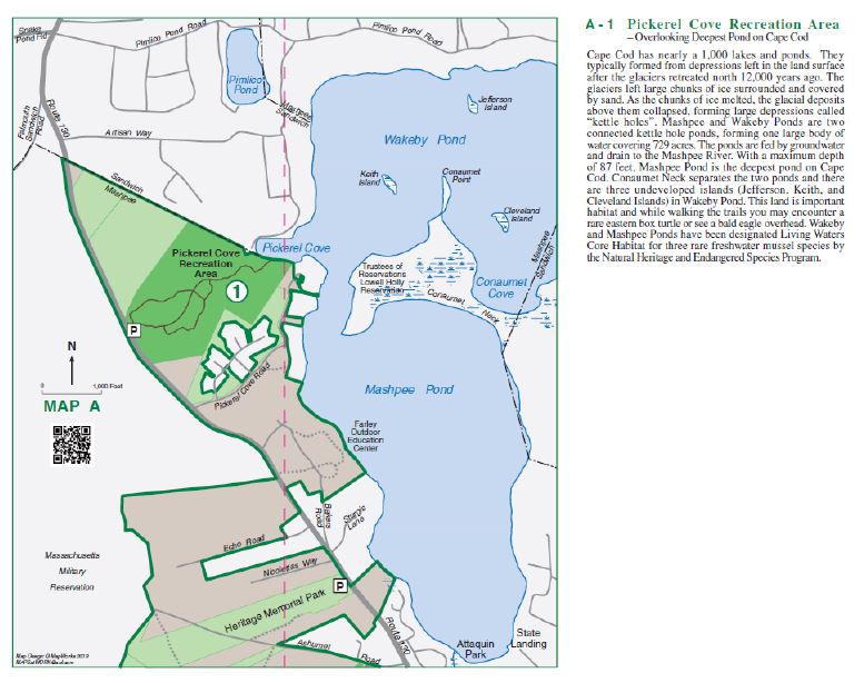
Pickerel Cove
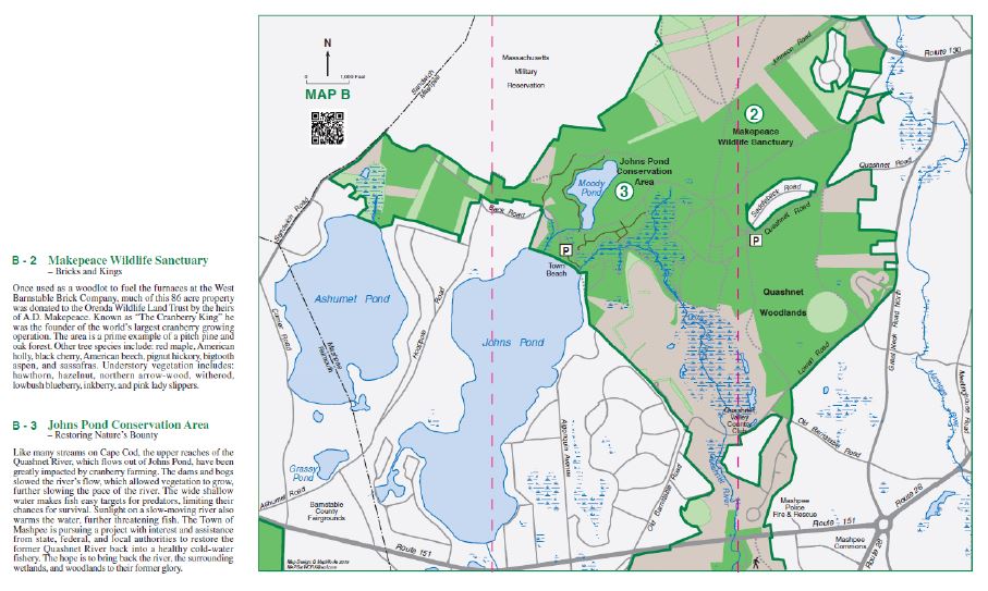
Makepeace Wildlife Sanctuary
Johns Pond Conservation Area
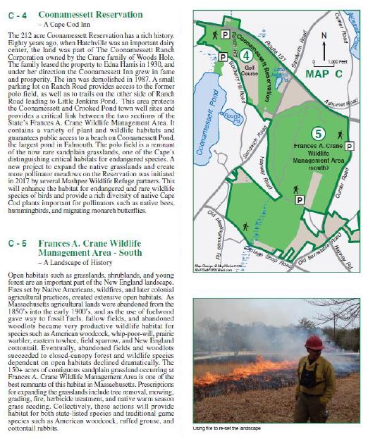
Coonamessett Reservation
Frances A. Crane Wildlife Management Area – South
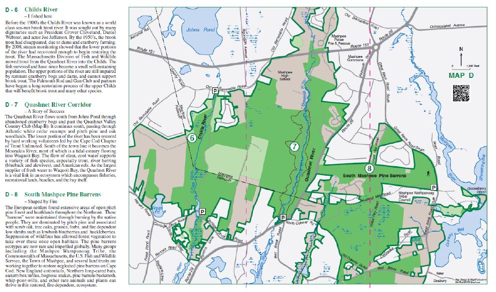
Childs River
Quashnet River Corridor
South Mashpee Pine Barrens
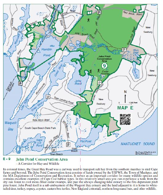
Jehu Pond Conservation Area
INDIVIDUAL TRAIL MAPS AND VIDEOS
Childs River
Johns Pond
Makepeace Wildlife Sanctuary
Quashnet River
South Mashpee Pine Barrens
Pickerel Cove
Jehu Pond
Coonamessett Reservation
 View Coonamesset Reservation Trail Map
Frances A. Crane Wildlife Management Area – South
Here are more Trail links to the Refuge Partners properties that are outside of the refuge boundaries but connected to these conservation lands:
Waquoit Bay National Estuarine Research Reserve Trails
Town of Mashpee Trails
Fun Interactive Mashpee Town Maps